Play all audios:
BY VISHAL GULATI New Delhi, March 4 : High resolution satellite imagery indicates that mass movement activities are still occurring where the rock and ice collapsed that led to a disaster in
Uttarakhand last month, as per latest observations of national and international scientists. In case of another slope failure and avalanche, this can be critical for people and
infrastructure downstream, close to the riverbed. On the another disaster in the making, scientists working under the Glacier and Permafrost Hazards in Mountains (Gaphaz) — a standing group
of the International Association of Cryospheric Sciences and the International Permafrost Association — believe large volumes of material have been eroded and deposited along the river
channel. In combination with water from rivers, snow melt, heavy (monsoon) rainfall or overflow of temporary lakes, debris flows can be triggered from these depositions. They say erosion by
the flood probably has undercut some slopes, and this instability could affect roads, villages and other infrastructure located far above the riverbed. Scientists and environmental
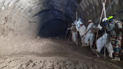
organisations are still researching the cause of floods in Chamoli district. Early findings reveal that a major rock or ice avalanche detached itself at an elevation of about 5,600 m above
sea level from a north facing slope northeast of Trisul Peak in the Nanda Devi mountain. This caused the massive floods in the Rishiganga and Dhauliganga rivers that left 204 people missing
out of which 72 bodies have been recovered so far. Analysis of satellite imagery from the area shows this event occurred due to failure deep within the bedrock of the mountain, and the
glacier ice was most probably entrained with the collapsing block of bedrock. The failing mass covered an area of around 0.2 km. They explained to IANS the depth of the failure plane is more
than 100 metre below surface, where no seasonal temperature variations are expected. The zone is in permafrost conditions, meaning ground temperatures are perennially below zero.
Speculations are that heat fluxes from the warmer south face of the mountain to the colder north face, where the avalanche detached, could have warmed the frozen bedrock, leading to the
avalanche. Furthermore, liquid water from snow and ice melting could have infiltrated the bedrock in cleft systems and destabilized the rock through freeze-thaw processes. Historical imagery
also indicates that a similar event has occurred in the neighbouring glacier just east of the current in September 2016. However, the initiation of the failure as well as the eventual
trigger of the avalanche remains unclear. Unstable geological configuration and steep topography can, on its own, be a sufficient driver of large slope failures. Christian Huggel of the
Department of Geography in the University of Zurich said the response to this disaster of the national and international science community was extraordinary, with first analyses being
provided to authorities within just about 24 hours. “While the Himalayan region is particularly prone to, and impacted by climate change, enhancing mass movement turn-over such as sediment
flux, or extreme events as in Chamoli, large slope failures (rock-ice avalanches) as in the case of Chamoli and Ronti Peak are often difficult to attribute to climate change. “Such efforts
need in-depth understanding and field and remote sensing data, for instance on geologic structure, permafrost occurrence and thermal distribution and perturbation, glacier decline history
and mechanical stress changes in the affected steep slopes. Thorough investigation of the case will improve our understanding on all levels and hence provide the basis for targeted actions.”
Indra D. Bhatt, Scientist with the G.B. Pant Institute of Himalayan Environment and Development, said this disaster happened in a village where the Chipko Movement (hug the trees) was
started and the views of local people indicated that the number of hydropower projects in this fragile ecosystem is responsible for such disasters in addition to climate change. Added
Carolina Adler, Executive Director with the Mountain Research Institute of the University of Bern, “In the longer term, it is inevitable that in such high, remote, steep, sensitive, rapidly
warming, and deglaciating environments, large infrastructure projects can be exposed to considerable natural risks.” According to a report released by the Ministry of Earth Sciences last
year, the Hindu Kush Himalayas experienced a temperature rise of about 1.3 degrees Celsius during 1951-2014. The increase in temperature has led to micro climatic changes and faster glacial
retreat in Uttarakhand, thereby triggering frequent and recurrent flash floods. A recent independent analysis by the Council on Energy, Environment and Water (CCEW) says more than 85 per
cent of districts in Uttarakhand, home to over nine crore people, are hotspots for extreme floods and its associated events. Studies say the Indian government aims to construct 292 dams
throughout the Himalayas, doubling current hydropower capacity and contributing approximately six per cent to projected national energy needs by 2030. If all dams are constructed as
proposed, in 28 of 32 major river valleys, the Himalayas would have one of the highest average dam densities in the world, with one dam for every 32 km of river channel. (Vishal Gulati can
be contacted at [email protected]) Disclaimer: This story is auto-generated from IANS service.